Friday, August 14, 2015

Actually Vacation in Banff - Aug. 13, 2015

For once, there wasn't a time prescribed to leave the condo, so it was a more relaxed morning. A dad and his kid were in the fitness center, and the kid kept talking about how many calories he burned on each machine. I just watched and learned about explosives on the National Geographic Channel.

Mom made pancakes. There was honey from Greece thanks to Valerie and Ben. There was also nutella, peanut butter, and blueberries. And bacon.

My ideas for the day centered around two breweries and a distillery in Banff. The distillery wasn't doing its tours. One brewery (Grizzly Paw or something) only did tours on weekends. The other only did them on request, which made us feel like it wasn't worth going to. So, we ended up with a few walks instead.

First, though, Canmore was having its farmers' market, and we had to wander around that. There were artisans selling jerky, jewelry, and produce. We got some of each. We walked up Main St. to a flannel shop. I peeled off to find a post office, then found everyone in, surprise surprise, a bookstore. We probably spent slightly more in there than in the game store a block away. We did purchase "Three Cheers for Master", a macabre cheerleading, physics, card-lying game. Dad couldn't purchase the stone gothic arches at the book store, sadly.

It was home for lunch, then the next "plans" were made. Mom and Dad found out there was a geocaching coin one could get for doing 3 of the 10 easy/moderate caches around Banff. They had done three yesterday (Vermillion Lakes, Fenland Trail, and Cave and Basin's Marsh Loop) just in case, but we had two more on my list for today - the Hoodoos and the Bankhead Trail.

I could only find one mention of a Hoodoos Trail in the piles of brochures I was carrying around, and that was a 3-mile hike starting in downtown Banff. We packed up the cars, and Valerie and Ben followed us in the Subaru.

I looked at the map of the Hoodoo Trail, and there was a parking lot at the end of it, like, right where the viewpoint was. Turns out, you can just drive there. Since all of us were less in the hiking mood, more in the "vacation" mood, we just drove to the parking lot, then walked the 1/8 mile to the overlook.

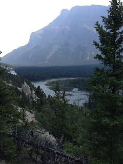
We found a geocache, saw a stand-up paddle-boarder, watched some ravens pretend to be eagles soaring on the thermals, and got wind-whipped. The hoodoos were different than those we saw in Utah like a decade ago - more peak-like, and along the Bow River - but the geologic premise (that a "cap" prevented them from eroding like the road around it) remained the same.


The geocache was found, trivia was learned, and we headed back to car. Since that hike wasn't a hike at all, we headed straight to Bankhead, an interpretive trail about the town of Bankhead.


A mining town for 17 years, Bankhead had been told to remove itself from existence by the government presiding over the national park in about 1925. With coal prices down, it was no longer convenient to have a mine inside a protected zone. All buildings were removed (with the exception of the transfomer house), and the mine was shut down. As we walked around the gravel trail, each piece of ruin told its story of a family whose lives were changed when a town disappeared underneath them.

We hopped onto a train car, but otherwise, were told to avoid contact with the rhubarb and raspberry bushes from backyards of former houses, because there are known carcinogeons around the abandoned mine.

Both trails were exactly what we wanted - to learn something, to not sweat in the (gasp) 85-degree weather, and to not have to have hiking clothes on.

We circled around Johnston Lake (which looks very similar to a power plant) ad found some mountain sheep, right on the road. There was a "wee" one with his mom. The males are much more weaned then


Thursday, August 13, 2015

Driving the Icefields Parkway - Aug. 12th, 2015

Valerie, Ben, and I split off from Mom, Dad, and Deanne today. We wanted to head north to the Columbia Icefield, which they will see on Friday as they head up to Jasper to camp.

There was a fair amount of driving involved. The Athabasca Glacier is 100 km past Lake Louise, which is already slightly over an hour away from Canmore. I dictated we leave at 8am so we could have some flex time and still be back by dinner. Valerie and Ben begrudgingly agreed.

We were actually only about ten minutes off of that time - the closest we've been all trip. Good thing it's a vacation and no one is actually timing us.

In our "efficient" leaving, we also left:
  • Sunscreen
  • Bugspray
  • Bear spray
  • First aid kit
  • Hand sanitizer
So, we got our food and now we're sunburnt. But not bitten, by bears or bugs.

There was a coffee stop in Banff, then we were on the road. Our first stop was Bow Lake and the Num-Ti-Jah Lodge. We walked by the lake, which had "waves," unlike the rest of the glacier lakes we've visited in the last few days. It wasn't bigger than Lake Louise, but I guess it was less sheltered, and the wind sweeping through the carved valley was stirring up some current. We could see our "first" glacier, Crowfoot, hovering over the water.

We popped in the lodge, admiring the furs and postcards. (I bought some of the latter, not the former.)

Next up the parkway was a mini-hike up to the viewpoint over Peyto Lake (it's pronounced Pee-toe) at Bow Summit. It wasn't quite a walk, because it was pretty steeply uphill, but it was paved the whole way, with a boardwalk overlook. It was another glacier - the Peyto Glacier that fed the lake, named after a mountain man the "didn't care what anyone thought." I looked him up, and he was a trail guide and one of the first park rangers, but had a style of his own. The lake was named after him because the typical campsite by Bow Lake got too crowded, so he'd hide out at his own lake. He also wore a sombrero at a rankish angle.


After that exhausting uphill/downhill, we had plenty of time to rest as we passed the Waterfowl Lakes, crossed over the Saskatchewan River, and glanced at the Weeping Wall (with intentions to go back to the last one on our way back south).

We were originally going to just drive past Bridal Veil Falls too, but about 100 yards before the turnoff, a lone mountain goat was eating five feet from the road. We pulled over, saw enough of the waterfall, then watched the goat for a bit.

It was making its way up the road, a few feet every few minutes. "Hey," I thought to myself, "Aren't goats herd animals?" And, staring up the rock face on the other side of the road, I spotted another goat and a kid (baby goat). We watched them, then as we were going to turn and set off again, those that we spotted started moving - along with another goat and another two more kids that we missed the first time.


They wandered into and then across the road. If you are really good, you might see the three on the hillside to the right, and the two that are left of the RV just past the road.

We continued to the Icefield Center. When we checked online yesterday, there were plenty of tickets for the 90-minute "CAT" tours of Athabasca Glacier, since it left every 15. After using a restroom with running water (small successes!), we were told that they weren't selling day-of tickets. We had lunch, confusedly, because the two different UK families we sat with both had tickets and intentions of going out on the ice, until we learned they were honoring previously purchased ticket. Ticket sales were being delayed because of some "large incident" that the employee didn't know more details about.

So, bad news - our big adventure on the icefield (though technically just a glacier - the icefields are beyond the crest) was not going to happen, But, we also didn't spend $55 a person to go walk on some super-compacted ice. We did walk up as close as the public is allowed to Athabasca. The temperature dropped ten degrees as we walked up then across the scree to the boundaries of safety.

Not to be thwarted, we continued up the Icefield Parkway to hit two more stops before turning around: Tangle Falls and the Stutfield glacier.


The falls were very pretty. No mountain or bighorn sheep, though, despite the fact the guidebook told us to look. The glacier was another geologically grand piece of the icefield puzzle.

So, about this icefield - it is cradled in the mountains, with at least half a dozen glaciers fingering off through the passes in between the peaks. It is a hydrological apex - the runoff goes to multiple oceans. In this case, it is the Pacific, Atlantic via the Hudson Bay, AND the Arctic! There are only half a dozen like that in the world.

We decided that a roughly hour-long hike (it was around 2:30) would serve us, so we found Wilcox Pass. The "first viewpoint" was an hour round-trip. The entire trail was 8 km and 2-3 hours.

Well, we got a viewpoint at 3:30. A man showed us two mountaineers climbing one of the peaks that was covered in snow. There were cute red chairs to sit in. We had climbed uphill that entire 45 minutes. It would have been great to call it a day right there...


But there was this ridge the hikers were disappearing over as they continued walking along. "Maybe just to the ridge."

Do you know the song "The Bear Climbed Over the Mountain"? Bear climbs up, then sees anther mountain to climb.

That was similar to our experience. It wasn't like we were that tired, or that hungry, or that we had to be anywhere. It was the after each ridge was another one, and another one.


The ridges actually started blocking out the glaciers. The alpine meadows weren't quite the brilliance that Valerie was expecting. The river we were following was deep in a canyon, so not  many good looks there either. It was really apparent that this hike wasn't our best when Ben bled not once, but twice - from a mosquito and from a "spiky" spruce (unlike a "friendly" fern). Not great, but not bad. Just kind of annoying.

We had our snack, did some dog-watching, then we started our hike back as all. Really, it was the red chairs that were the highlight of the tour.

So, our final push back to Canmore. I drove, and I missed the Weeping Wall somehow. But, peeked at the instructions before hopping in, and there was a walkway at Lake Herbet to stretch our legs.


Well, Lake Herbert turned into "lake with an H name." We stopped at Lake Helen - 6 km trail and blocked off because of bears. Odd. Then Lake Hector came up. It was probably Hector that I was thinking of. Except Hector just had a pull-off.... Lake Herbert!

Lake Herbert was calm, clear (no glacier flour), and relatively warm. A few families were taking advantage of the picnic spots around the parking lot and the warm day to go for a float and a dip.

We made it back in time for supper. The risotto that Deanne and I made a crazy ton of a couple nights ago was now being repurposed as fritters! I had to supervise and make sure there was enough oil to actually fry them, and not just saute them.

After dinner was hot-tubbing. After hot-tubbing was finishing the game of dominos from a few nights ago. (I won!) After dominos was the Perseids meteor shower! I saw about three big shooting stars, including the last which had a tail, it was so big. No one got run over, either, despite using the driveway to the place as a backyard.

Tomorrow is city stuff - or as "city" as you can get in towns like Banff and Canmore!
Wednesday, August 12, 2015

Matter of Minutes - Aug. 11th, 2015

There was a quick fly-by change of plans last night. Instead of going to the ice fields, we convinced Dad to take a family hike up to the Plain of Six Glaciers Teahouse.

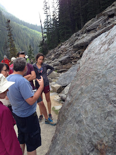
I definitely was instrumental in convincing everyone - the idea of teahouses halfway up mountains is so quaint that I wanted to participate in the afternoon tea while in the middle of a hike. Of two teahouses (Lake Agnes and Plain of Six Glaciers), we chose the one that also offered views of six different glaciers. It took some Googling, but the six glaciers are Aberdeen, Upper and Lower Lefroy, Upper and Lower Victoria, and Pope's. Can you see them, left to right?

(Yeah, neither can I. And it's not just the fat dude in the way.)

Well, we didn't quite get the 9am start we were looking for, but 9:30 was close. There were a couple cars pulled off at different points when we took the hour-long drive back to Lake Louise (since we were just there yesterday), but we didn't stop to look for animals. Which was perfect, because we got some of the final "spots" (at that point, it was merely concrete surface area - lines were a formality) in the parking lot at Lake Louise. Another minute, and we would have been circling for ten, or parking hundreds of yards away.

We trotted off, along the same path as yesterday's geocaches along Lake Louise. That was the first mile. The next mile was some decently high grade. Then a mile of gradual slope. Then, the trees began to decrease.


We were high above Lake Louise. Abbot Pass, named after the "first" mountaineering fatality in Canada (though we all decided that it was probably just the first by European settlers) was across a pit of gravel and scree that hid the crevasses to a glacier.


We stopped to have lunch (given that it was 1pm - our 6.6 km/4 miles took two hours). The critters that were around every picnic area were checking us out too. The magpies quirked their heads at us; one ground squirrel was bold enough to put his paws on Valerie's thigh before she shrieked. (That yell helped her out a week and a half ago when her phone was stolen.)

The slight sun-basking on flat rocks on the scree pile made it hard to get up and walk the final 2/3 mile to the viewpoint, but hike we did. Uphill, with a hyperbolizing groaning father in the rear.

However, he was also the one that called out, "A big one is falling!" Not to be taken in by his hijinx (but also wary enough to check out the surroundings), Mom and I both saw no rocks falling... because it was an avalanche cascading off the mountainside opposite us.

A video, you ask? Sure:


We played in the scree pile for a bit as Valerie and Ben headed up the path toward a waterfall. (There was apparently some skidding involved on their part, but Mom, Dad, Deanne, and I all stayed on our feet.)

We had planned to meet up with them back at the teahouse - the exposed slope of the mountain was a bit chilly for just dilly dallying. On our way back, we ran into two of Valerie's friends from Alabama we had seen on the street in Banff the night before. Shortly after we told them of our avalanche and continued down the trail, we heard the rumblings of another small ice slide. Well, "small" in that grand scale.

We found those lovely flat rocks again, and waited for Valerie and Ben. It was mid-afternoon, but the first hike wasn't all that tough... and there was something called the "Teahouse Challenge"...

Valerie, Ben, and I peeled off to do tea at the teahouse before hiking on to Lake Agnes. The other three started back down the mountain.


We pretty much remained along the treeline as we went along the Highline Trail. It was gradually downhill for a few miles, which meant once we hit the forest, we were starting to hike steeply up to Lake Agnes.

We've been seeing some great wildflowers and berries. Summer is short in these mountains! I caught a bee headed to some lupine (or other flower... I'm not too concern).


Lake Agnes was named for the first two women that got to it - thankfully, both were named Agnes. It is nestled between two "beehives" (rounded mountains) and is framed by a range in the background as well.


More tea, a half game of Love Letter, a mountain square (graham cracker crust, chocolate chips, raisins, coconut), and some of their delicious brown oatmeal bread and hummus, and we were headed back downhill to drive back to Canmore and meet up with the parents.

Oh, I almost forgot to mentioned the best part about the hike! The teahouse was situated right over a waterfall from Lake Agnes down to Mirror Lake!

We stopped at the lodge to pee, then got home in time for sausage, broccoli, beer, and a game of Istanbul. Dad won - shocking, right? Pretty good for a guy we dragged around for ten miles.


Tuesday, August 11, 2015

Lake or Lac or Lack of Animals - Aug. 10th, 2015

First comes Canmore. Then, twenty minutes up the road and into the national park, comes Banff. Continue for another 45 minutes, and you've reached Lake Louise.

Though, in our case, we didn't actually reach Lake Louise until 4pm - we were too busy finding other fun to do around it instead.

We headed out at 9:30 to get to the Lake Louise Gondola (which is at the ski area near, but not on, Lake Louise) and some of the best bear-viewing acreage in the area. The ski slope is closed in the summer, and it is kept as habitat for bears - humans can only glide over it, drooling for a chance to see one of those macro-mammals.


As I mentioned, we were in the park, so the first fifteen minutes we spent just waiting for Valerie and Ben to buy the pass they hadn't on the way in. We passed the Columbian ground squirrels, grazing and popping out of their dens, down to the ski lift/gondola.


The ride up the 1200 or so feet was smooth and stunning. We could make out Lake Louise, nestled in the ridges of the mountain range opposite. The hillside rose with spruce and shrubs along what we guessed were blue ski routes. We swung in the open air, only slightly chilled by the slight breeze of a 14-minute ride up a mountain.

A group that passed us said they had seen a grizzly "up and to the left." I bet you know where my eyes were straining for the entire trip up.


 As we reached the top and began quizzing the attendant about the bear. "Yeah, she's up on that slope somewhere. She likes to wander around up there." She, of course, had strolled over the ridge as we were traveling up to see her, so grizzly fail #1.

There was a walkway to the interpretive center, but that was the only trail that was open because of the "bear activity." We reached the center just in time to hear the majority of the "pyramid of life" talk that a ski instructor-cum-park employee exuberantly shared with us.

Having a diverse plant life begets diversity in the herbivores, which leads to supporting multiple predators. However, the Lake Louise example of human interference came with the idea of preventing wildfires. Fires are needed habitually to clean the forest and increase diversity. The lodgepole pines in the are had become the prominent species, choking out the sun-loving and quick growing aspen, that thrives after a forest fire. The aspen had photosynthesis in its bark, so species that don't hiberate need it for their sustenance during the winter. The caribou required it, and once it was gone, they moved down into the Banff Valley so it would satisfy their hunger.

What's the issue with having all your caribou in one place in one park? Something might go wrong. And in 2009, it did, with the entire herd of about four dozen caribou buried underneath an avalanche. There are ideas to eventually re-introduce them, but first, think of the people that are controlling fires for us to restore their habitat for eventually re-introduction.

We had a buffet lunch, sitting next to a couple from El Paso and asking for their highlight reel. Once we left the cafeteria (and its hordes of tourists), we drove to the entrance to Moraine Lake.

A giant "Road Closed" sign blocked our way. A park employee was holding traffic outside as those that were leaving (and opening up parking spots) came out in ones and twos. After five minutes, we were released into the parking lot to find a spot.

Valerie, Ben, Deanne, and I rented canoes, partnering up and setting off.


We made it all the way across the lake to one of the feeder streams (which was a picturesque little babbling cascade).

Mom and Dad sat on a bench and read while we did this - I think we've started to wear them down.

Moraine Lake had served its purpose (blue, can canoe on it), so we left it behind for a late afternoon drive to Lake Louise and its famous inn.

Which originally was a small chalet, and has grown into a massive hotel, which is Swiss-inspired. The mountaineers that came to build trails and lead guests were all from Switzerland. Sadly, the bell boys had to run around in short pants and suspenders,

It was a hazier day, but the views down the pond were still stunning.


 Dad had downloaded a few geocaches, so we got a chance to explore those riddles. One was estimating the volume of rock in a giant skree pile. The clue itself involved multiplying a height and radius to get the volume of a cone. This then led to roughly ten minutes of us attempting to derive the formula for volume of a cone.


We failed, but there was some writing on rocks with other rocks as chalk by the end of it. We thankfully transitioned back into recent reads before the end of the hike.

It was 5pm, and we had some driving ahead of us. Instead of the faster highway, we were taking the Bow Valley Parkway, which paralleled the speedier route, but had better opportunities for wildlife viewing.

We got to an overlook about 3/4 of the way to Banff, after not spotting any along the road, and started peering at a valley below with our binoculars. Dad saw some movement along one of the lakeshores - a moose! Or... birds resting along a craggy stump.

With our lack of large mammals, except ourselves, we drove into Banff to find a place for dinner. While we didn't successfully spot any wild animals, Valerie managed to spot a pair of college friends from Alabama that she hadn't seen in a few years. Small world... small, human world.

We ate and drank at Saltlik Steakhouse until dark (which is pretty late in these parts). As we were getting the check, we realized that we hadn't actually figured out what the plan for tomorrow was.

Ice fields? Hike? We are probably headed back to Lake Louise and a steep hike to a teahouse, but stay tuned!

Monday, August 10, 2015

Cycling Marathon - Aug. 9, 2015

Before I get anywhere....


Yesterday's blog post(s) were missing some pictures, so I'll remedy that. Mountains. Surrounded by mountains.

This morning was an omelette kind of morning. The scent of Dad cooking bacon wafted under the door at 8, so of course... I hit the gym first, and encountered some other guests groaning their way through crazy workouts.

Our plan was to bike from Canmore (the town just down the hill from the condo) to Banff... and back. The first idea was to just rent three bikes, and half of us go one way, and half go the other way. Everyone was excited about both ways, so we headed out at 10 to rent bikes.

The first shop we went to had four bikes. But Sports Experts let us call around, and we found Valerie and Ben bikes at the Ramada nearby.

Originally, we were all going to bike along a trail that started near the Nordic Center - but it was "rooty and rutty", so the only options were Goat Creek Trail, at the top of a dusty gravel road past Grassi Lake, or riding along the highway.

Valerie, Ben, Deanne, and I all were excited about Goat Creek (and I think Dad was too, but sadly, someone had to drive, so he sacrificed for us kids), so we drove a Jeep full of bikes and a Subaru full of people up, then Mom and Dad drove them back down to the bike shop, where we would all end up this afternoon.

In the process of getting the bikes in and out, my back wheel "quick released" itself. We had another bike to model it after, so assembled it with a few minutes of work. Ben attempted to make football stripe grease stains on Val's cheeks - I was just content with wiping as much off on a bandana as possible.

The first hill of the trail was one of the steepest we encountered. Then, the biggest puddle of the entire trail had me and Deanne walking our bikes through the woods around it to avoid getting mud splashed.


(I later got splashed a bit; black pants with pretty dust polka dots were my ensemble by the end. The idea of cleanliness became over-rated.)


 Most sweeping views were blocked by trees, but the trail was calm, save the gravel spewing out from under our tires


 The trail to Banff along Goat Creek was about 19 kilometers. That's nearly 13 miles. We chugged along, and found a few rolling hills that were really starting to take the wind out of our sails. The last straw was the sign that said "Banff - 9.9 kilometers". All that, and we weren't even halfway?


 There were only three more big hills before the great downhill came. The pro was that each of the uphills started as a downhill toward a cute little bridge and some babbling brook. I started to hate bridges by the end though - it was just an indicator of sweat on the way back up.

We hopped out at Fairmount Hotel. It's a castle. From a website:
We coasted down the hill past a small gaggle of tourists taking a picture. Ben goes, "It's a reindeer!" We investigate to find a five-ish point buck hanging out by a log cabin.


But that wasn't the only log cabin we were seeing that day! It was Open Doors Banff! Once a year, a dozen or so of the historic houses, some now private residences, invite guests in to hear about their history. We poked into a few, learning about the Luxtons, the Whytes, and this guy named Wilson who did everything from put Lake Louise on a map to help found the Canadian Alpine Society. The latter one we learned while at a graveyard tour.

But, we had a return trip to make, and Val and Ben's bikes had to be back by 6pm. At 4:15, we took off. #bikeselfie!


The trail was so smooth compared to bouncing down gravel. It was a bit longer, at 22km or so. At 5pm, we stopped for a group picture at a little over the halfway point, then Ben, Valerie, and I continued on to Canmore, sit-bones aching, to turn in their bikes and grab groceries for dinner.

Deanne and I were cooking. I grabbed everything I could remember from the store, then met up with everyone else and got the rest of the list from Deanne. We were in the kitchen cooking by 7, while the rest of the family headed to the hot tub to relieve those sore tushes.

After we served a blueberry-walnut salad with chicken and chive risotto with a side of grilled eggplant and zucchini, Dad said to not expect food that quality on their cooking night.

It should also probably not be in that quantity either. The bag of risotto rice seemed small enough, and doubling it to use it up seemed like a good idea, but now there's a blender-full of puffy rice using up some limited fridge space (and one of our limited containers as well).

Well, our second meal will probably also be risotto - glad everyone enjoyed it! And tomorrow - Lake Louise! (And sore tuckuses...)

Sunday, August 9, 2015

Tourist Traffic Jams - August 8, 2015

The moutains' majesty was very apparent once the sun was up. I was awake at 7, found the fitness center, then joined the family in the first of what I'm sure are a fair few brainstorming and planning sessions. Then, the first order of business - getting food.

My parents decided that there are six nights at the condo, and six of us staying here (my little sister Deanne is the one that hasn't been mentioned yet), so each of us is in charge of a night of food. In practicality, it means that we have all now partnered up and are doing two nights per pair.

But this shopping trip was just breakfast, lunch foods, and snacks. And it was still 12:30 by the time we got back to Dad (who volunteered to avoid the crazy and download geocache sites instead of trying to shove six to a car) and had our first lunch with the miscellaneous fare we had acquired.

We had found a "lantern tour" of the Cave and Basin National Historic Site at 7pm, and there was a pizza place in Banff that Valerie and Ben wanted to do for our first nights' dinner, so we decided we had to leave at 5pm to get there.

It meant that we had time for a hike! And, while I heard "grassy lake" and imagined walking peacefully around a serene pond, it was actually Grassi Lake, and a retaining pond up the side of a mountain that fed a waterfall into a reservoir.

We parked in an upper lot, then walked down the road to the trailhead. It was a pretty narrow bit, so with cars parked on either side, it was a single lane. Fine if everyone was headed in the same direction - not fine when some were trying to exit and others weren't letting them. We almost abandoned the hike to see the drama unfold.

We took the service road trail up, so it was graded (though not anything I would ever drive on).  The top had two pretty little lakes - there just happened to be power lines overhead and a pipe that helped feed the power plant below. There were rock climbers, dogs, kids in strollers and backpacks, and the shrieking one who was tearing down the trail (and making sure there wasn't a bear for miles).

Valerie and Ben split off to take a different path straight to the condo. The other four of us pattered down the "difficult" trail, with stone steps and great views over to the falls. Grassi was a nature lover and path builder, and he lived in Banff until he died in 1980 at the age of 90, so the lake was named for him. Not, as I first suspected, actually grassy.

The plan to leave at five was successful. A few showers, some changes of clothes, more discussion on tomorrow's plan (biking! old buildings!) and we were headed through Canmore. Which is easier said than done at 5pm on a Saturday. Cars were everywhere. The drive that took us 15 minutes to get to the Save On Grocery store in the morning was easily doubled. When we got to the edge of Banff at 5:45, with an hour until we were to report to the tour, we decided to switch the plans. We parked in the first two spots we found, got to a grocery store for some revitalization food (and to prevent the hangry from emerging), and idled our way through the rest of Banff, getting to the Cave and Basin at 6:30.

And it was all closed. The sun had emerged, and was beating down on us (as much as sun can when it is 80 degrees in the sun) as we circled the first building, then the second, looking for confirmation that this was the right place.

At 6:55, the gaggle of tourists was rewarded with the sight of a ranger. We paid our $10 each (Canadian) and were off. I got extra delighted when a costumed character (Richard - one of the discoverers of the hot spring) popped out and began with his lines.

We walked through a darkened tunnel to the hot spring - a geothermal sulphur-y pool that was lit by a strobe light and Billy's lantern. The water made it tough to hear, but the story of their discovery was told. It was 1883, and Billy and his brother and their friend would be rich!

We touched some of the water (from a bucket with permission - otherwise it is illegal), and tramped our way back through the tunnel to a train picture where the first Prime Minister "greeted" us. He told how he took the land for the health of all Canadians as he traveled across Canada on the CPR - Candian-Pacific Railroad. I was a little disappointed because they ran out of lanterns.

The tour ended with a stunning 10-minute film. (Mom and Dad took the floor because they miscounted seats or oversold tickets.) The beauty of the Canadian national parks is dazzling, and the polar bear cubs were pretty adorable as well. Given that we've just seen chipmunks so far (and a potential lynx by Ben last night), we might be lucky to see a macro mammal, but I'm not holding my breath.

The Tavern had bison pizza, and the twenty minute wait was made bearable by a stroll down to the bridge over the Bow River. The salads and pizzas were good, and the drive back to Canmore and the Worldmark resort was worlds better than during the tourist traffic jam earlier this evening.

Though there was talk of games, in actuality, we all checked our internet accounts then headed to bed. There is going to be lots of cycling in the morning!


Getting to Canada - Aug. 7, 2015

In typical Walters fashion, it was a convoluted process to get the uniting factions to the resort in Canmore, just outside Banff.

I was flying up from DC via Ottowa. Valerie was flying up from Atlanta via Salt Lake City. Ben was flying up from Atlanta via Toronto. We were scheduled to get in within an hour of each other, with my flight being last. I was to meet them at the Hertz counter where we were picking up a car.

Getting to the counter, I didn't see them. I wandered out to the garage... no sister + boyfriend. So I turned on my phone to connect to the free wifi at Calgary Airport.

Oh, speaking of the phone - I had spent the last hour in DC downloading some podcasts, checking email, and just generally running the battery low. This wasn't a problem until I rooted through my bags and couldn't find the charger that I thought I threw in. When I got to Ottowa, I spent an hour and a half of my two hour connection standing at a counter at the Apple Accessories store and playing on their iPod Touch while my iPhone was charging. I figured I'd save up that 80% for when I was by myself in Toronto at the end of this trip and just use others' devices while with them in Banff.

Back to the rental counter - Valerie had shot me an email that she was delayed by thunderstorms and Ben had missed his flight, so both of them were now coming in around midnight instead of 10pm (this is Mountain Time, mind you - so that's 2am Eastern). So I asked the guy at the counter if he could switch the rental to my name so I could do the paper. Nope - Valerie is a Hertz Gold, so needed her to get the discount. But, he did let me pick out the car then.

"I think I know what you're going to choose," he said, and began working his way through the keys. Mid-sized SUV - eh. RAV4 - eh. Jeep Wrangler? Yeah, put that one aside for us!

Valerie made it through customs and to the rental desk in the next half hour. We had just finished signing the paperwork and were going to check the status of his flight when he got off the elevator. Thanks to the built-in GPS, it was an easy ride to the condo, and we got into bed at 2am. The shuffling of pieces actually worked.